Weasel Fire update for the morning of August 6th

Weasel Fire - Extreme Fire Behavior, August 4, 2022 - USFS
Weasel Fire – Extreme Fire Behavior, August 4, 2022 – USFS

Using information from various online resources…

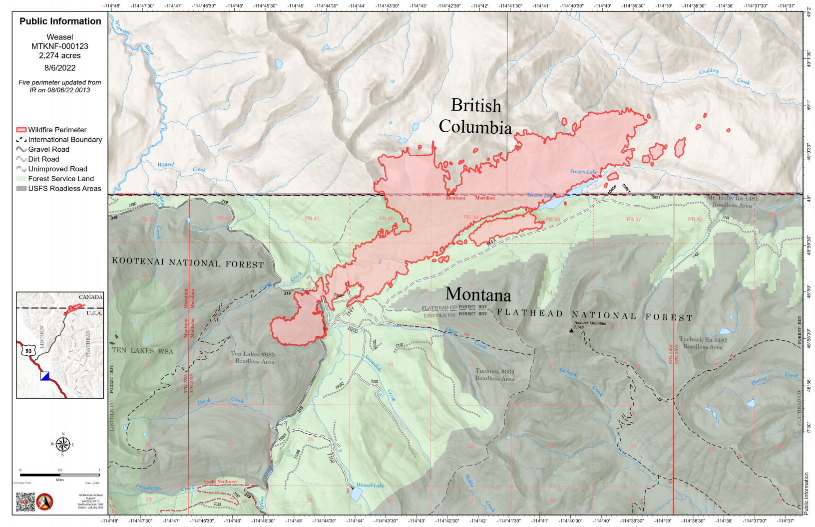
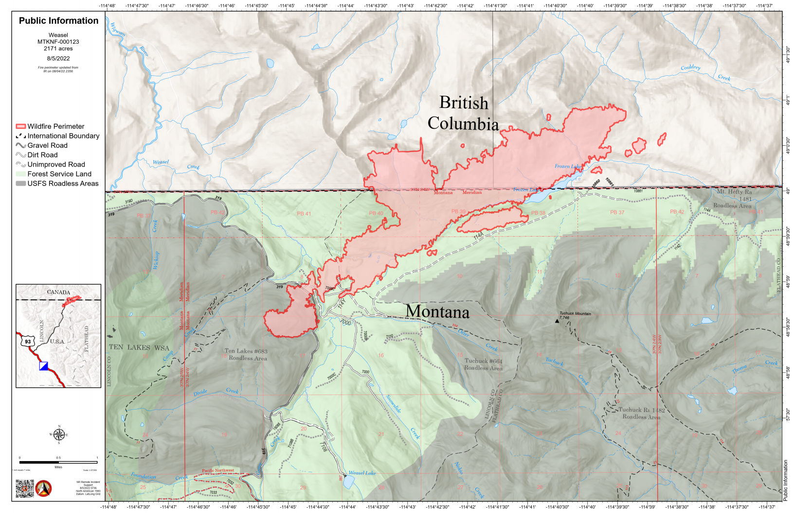
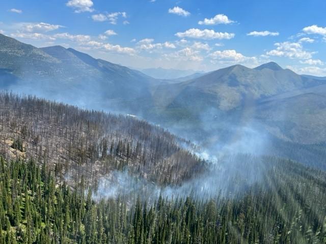
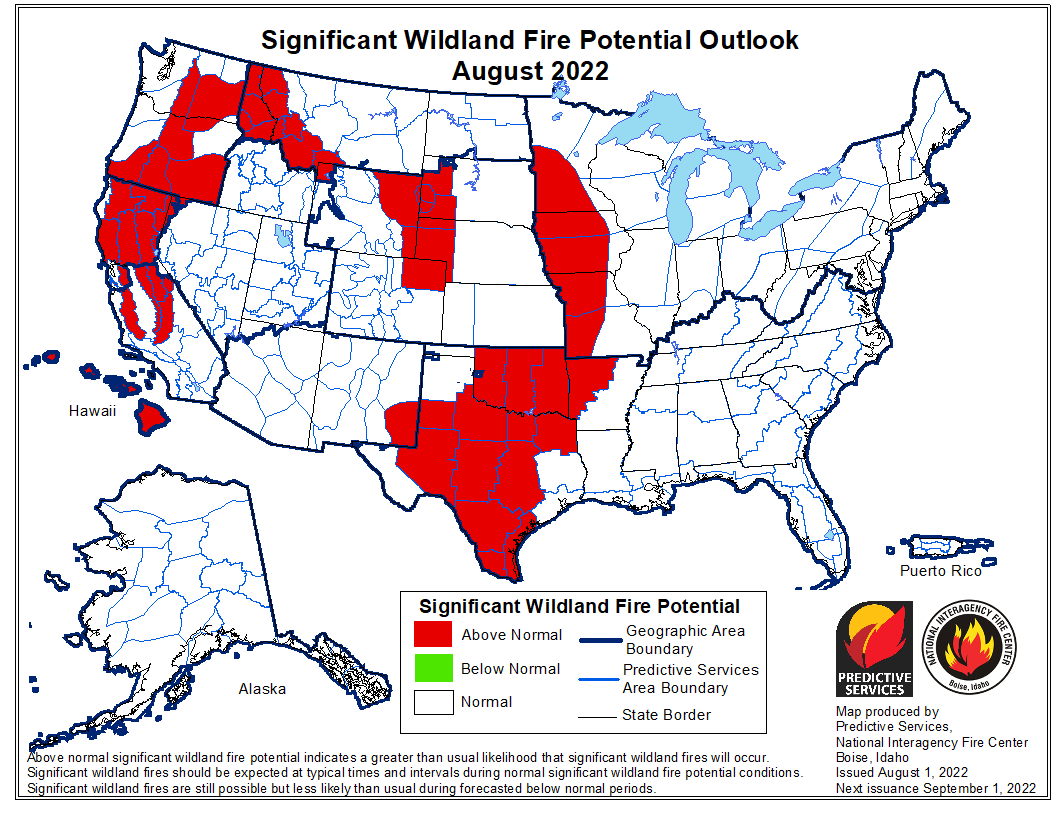
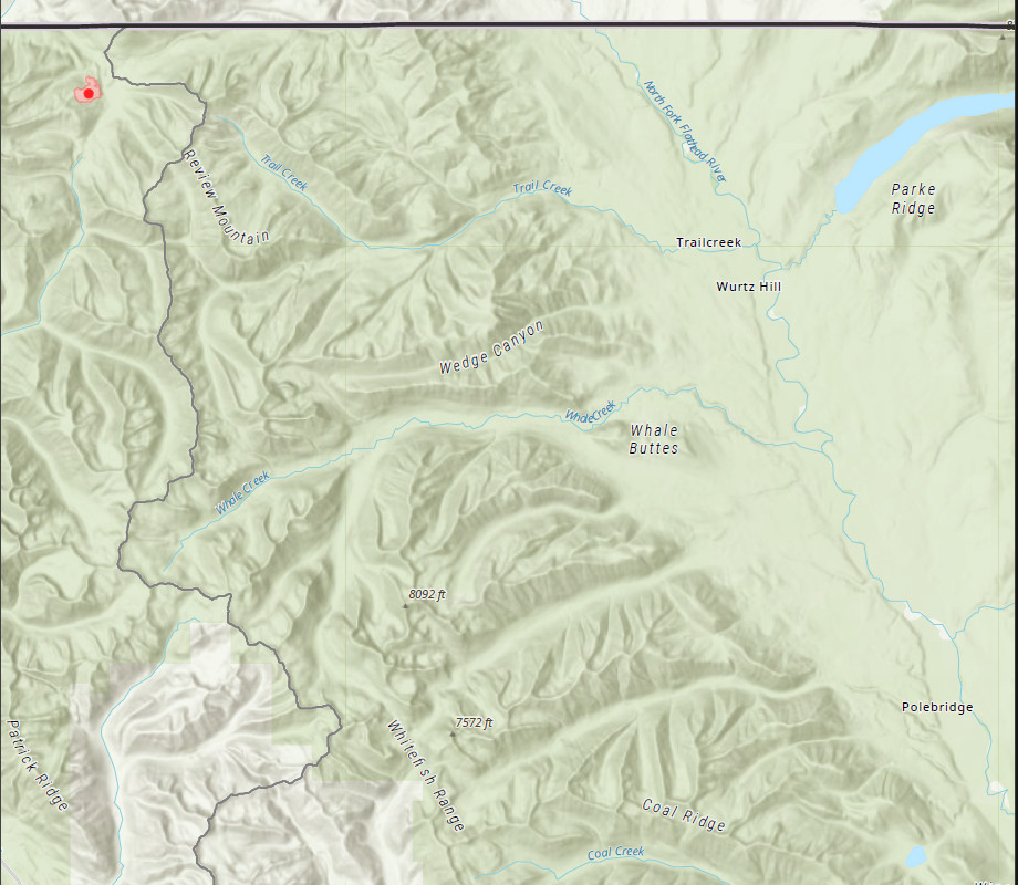
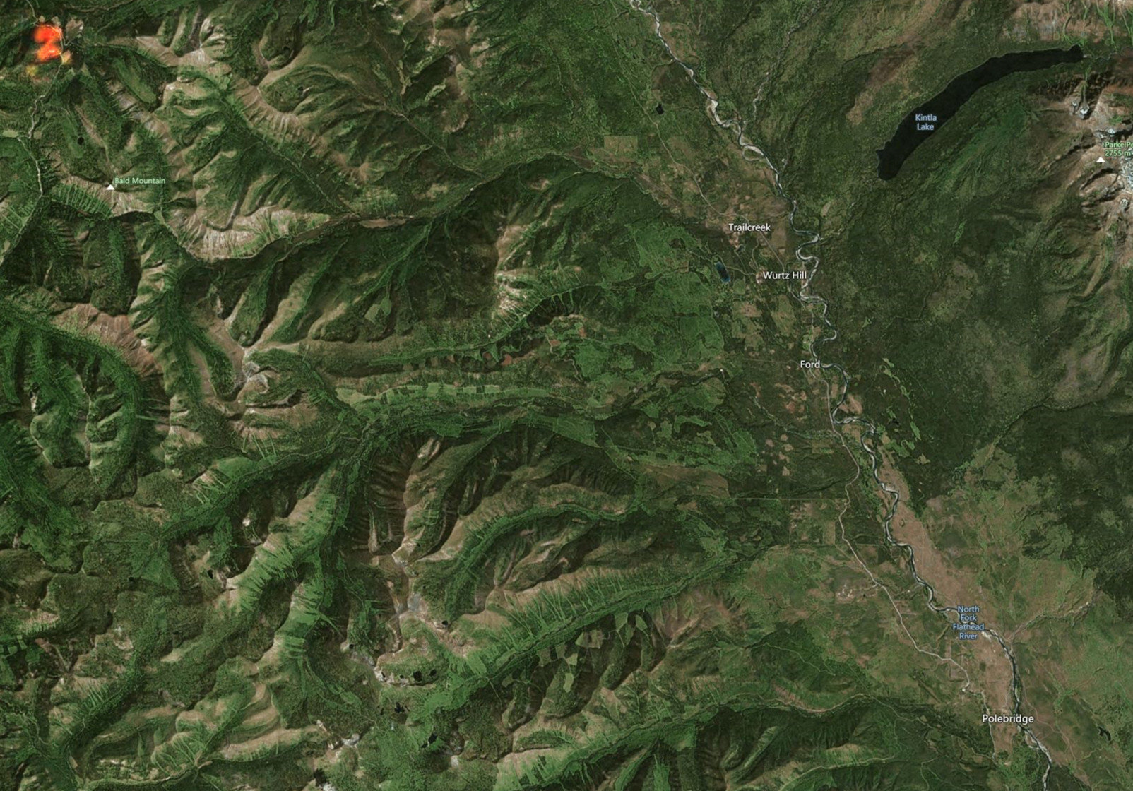
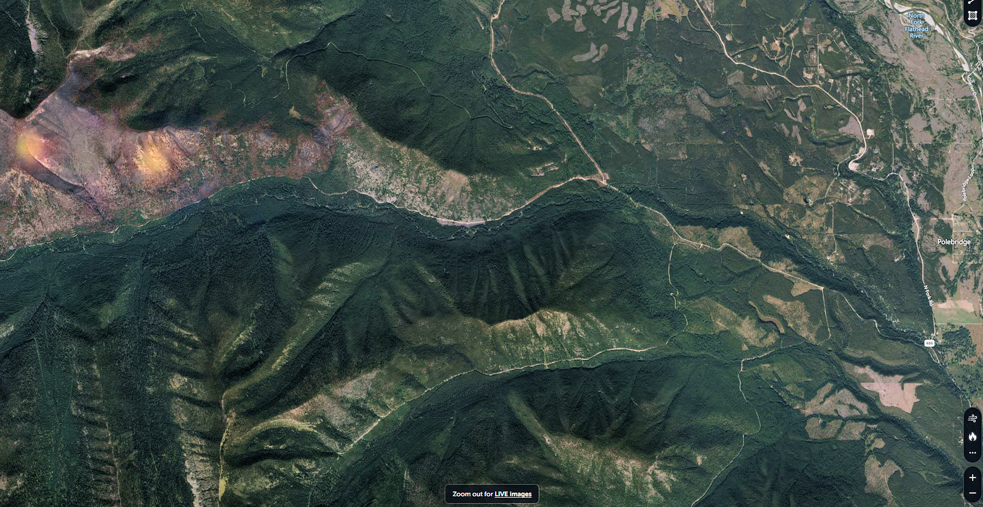
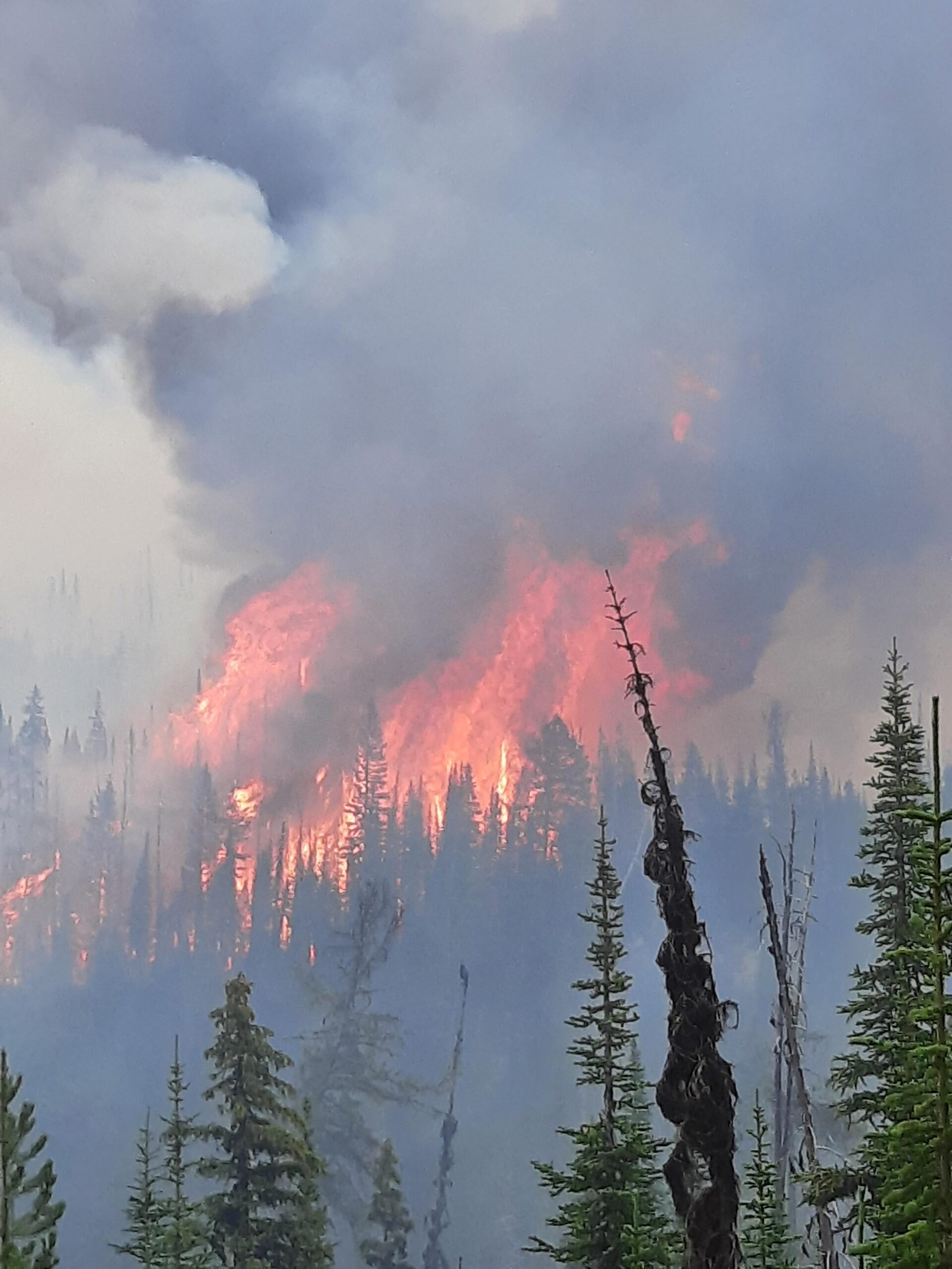
The Weasel Fire gained another 100 acres yesterday and is now estimated at 2274 acres. The blaze is currently burning in the Kootenai National Forest, the far northwest corner of the North Fork in the Flathead Forest’s Glacier View district, and in Canada. The Weasel fire has done a fair bit of spotting beyond the main perimeter and is still quite active. See the accompanying map for information on the fire’s extent.

There’s no official word yet on North Fork area trail and road closures, although it is safe to assume that at least some of the trails and Forest Service roads north of Trail Creek Road will be off-limits. There are no current plans to close Trail Creek Road itself.

Monitor the Weasel Fire InciWeb site for additional information: https://inciweb.nwcg.gov/incident/8290/. Also keep an eye on the NFLA website for fire-related postings.

Weasel Fire Map, August 6, 2022

Weasel Fire update for the morning of August 5th

Using information from various online resources…

The Weasel Fire, which began in the Kootenai National Forest, made a substantial run yesterday, jumping FS Road 319 and pushing northeast towards the Frozen Lake area and on into Canada north of Tuchuck Mountain.. It is now estimated at 2174 acres. The blaze is currently burning in the Kootenai National Forest, the far northwest corner of the North Fork in the Flathead Forest’s Glacier View district, and a substantial portion is in Canada. See the accompanying map for more information.

According to a note sent yesterday afternoon from Rob Davies, Hungry Horse/Glacier View District Ranger: “We are in touch with the Kootenai NF and the Canadians are in the communication loop as well. This is on Glacier View Ranger District and the lands consist of 5a Backcountry Non-Motorized Year-Round and 1b Recommended Wilderness Area and Tuchuck – Whale Recommended Wilderness.  There are no suppression actions planned at this time on the Flathead side of the fire.  We will be implementing/evaluating closures, updating signage and assessing any potential values at risk in the area.”

Monitor the Weasel Fire InciWeb site for additional information: https://inciweb.nwcg.gov/incident/8290/. Also keep an eye on the NFLA website for fire-related postings.

0930: Update from Andy Huntsberger, District Fire Management Officer: “We are… currently working on area/trail closures for this area.  We aren’t planning to close Trail Creek Road at this time but areas to the north of Trail Creek Road will be closed and some trails in the area will be affected.”

Bill

Weasel Fire Map, August 5, 2022

Weasel Fire pushes into North Fork; no risk to private property at this point

From Rob Davies, Hungry Horse/Glacier View District Ranger . . .

As of about 1200 today the Weasel Fire on the Kootenai NF has jumped FS Road 319 and is headed northeast towards the Frozen Lake area.  It is estimated that about 50 acres of the fire are now on the Flathead National Forest and the overall size is now over 200 acres.  We are in touch with the Kootenai NF and the Canadians are in the communication loop as well. This is on Glacier View Ranger District and the lands consist of 5a Backcountry Non-Motorized Year-Round and 1b Recommended Wilderness Area and Tuchuck – Whale Recommended Wilderness.  There are no suppression actions planned at this time on the Flathead side of the fire.  We will be implementing/evaluating closures, updating signage and assessing any potential values at risk in the area.  I have attached a map of the fire from this AM.  This does not include the fire growth from today but it will give you an idea of where the fire is located.  It should also be noted that there was a Weasel Fire from 2017 (3800 acres) on the Kootenai and Flathead and is directly east of the current Weasel Fire.

I recommend steering folks to InciWeb to find the latest-greatest info about the Weasel Fire: https://inciweb.nwcg.gov/incident/8290/.

Thanks,
Rob

Weasel Fire Map, August 3, 2022

Area wildfire status, morning of August 4th

Using information from various online resources…

The Weasel Fire in the Kootenai National Forest continues to grow slowly, reaching 162.38 acres according to the IR estimate posted this morning. It still poses no threat to the North Fork.

The Flattop Mountain Fire in Glacier NP continues to skunk around at 0.1 acres.

Weasel Fire Aerial Recon, August 2, 2022 - USFS
Weasel Fire Aerial Recon, August 2, 2022 – USFS

August/September/October Wildland Fire Potential Outlook

Greetings, All!! As you can tell, fire season is upon us, as Lynn Ogle has pointed out.

Here is the latest monthly outlook for August, September and October.
The good news of course is that we benefited from a cold, wet June and the first half of July. The bad news is of course the hot, dry weather that has been parked over us for the past couple of weeks or so. That is forecasted to persist for a while, and we are forecasted to have a more active than normal fire season for the month of August:

Continue reading August/September/October Wildland Fire Potential Outlook

Area wildfire status, morning of August 2nd

Using information from Lynn Ogle, Debo Powers (currently at Cyclone LO) and online resources…

The Weasel Fire in the Kootenai National Forest grew quite a bit yesterday, reaching 150 acres (see attached image). There was some spotting across Road 319 to the east, but it rained for 30 minutes and a helicopter made water dumps, too. It continues to be no threat to the North Fork.

The Flattop Mountain Fire in Glacier NP continues to hold at around at 0.1 acres.

Weasel Fire Location, 2 Aug 22

Area wildfire status, morning of August 1st

Using information from Lynn Ogle, Debo Powers (currently at Cyclone LO) and some digging through online resources…

The Weasel Fire is at 30 acres, up from it’s initial 10, and moving towards the northeast. It generated a lot of visible smoke yesterday, but is currently no threat to the North Fork. Location is in the Kootenai National Forest, 26 miles northwest of Polebridge (see image; fire location is in upper left corner).

The hot spots in last year’s Hay Creek burn disappeared from the satellite imagery overnight and there is no smoke from that location.

The Flattop Mountain Fire in Glacier NP continues to skunk around at 0.1 acres.

There were no other verifiable local smoke reports yesterday.

Bill

Weasel Fire Location, 1 Aug 22

Area wildfire status, morning of July 31st

Hello, everyone.

This is a summary of local wildfire issues based on information from Lynn Ogle and various other resources. No agency had issued any press releases at the time I put this together at 0720…

Glacier Park: Flattop Mountain Fire, 0.10 acres; initial report 29 July.

Flathead NF: Two hot-spots along the ridgetop in last year’s Hay Creek burn; FNF is sending a ground crew in to check it out; initial report 30 July. (See image below.)

Kootenai NF: Weasel Fire (sometimes called “D3 Weasel”), on the east slope of a ridge to the west of Weasel Creek. It was about 7 acres in extent initially on 30 July, is now 13.50 acres, and is being handled by the Kootenai National Forest. According to Bill Fordyce, “The Kootenai has put a lot of resources on the Weasel Fire. It’s a 10 plus acres. Some of that area burned 5 or 6 years ago so there would be standing dead and down…”

Bill


Approximate position, according to Zoom Earth, of the two hotspots in last year’s Hay Creek burn. The nearest is about 6.5 miles west of Polebridge. We should know more once Flathead NF gets some people up there to look around…
(look for the kind of orangy glows near the left edge of the image. Those spots are *not* to scale, they just indicate rough positions!)

Hay Creek Hotspots, approximate postions, 31 July 22

North Fork Fuels Reduction Field Trip, Wednesday, June 15

North Fork Fuels Reduction Field Trip Schedule, June 15, 2022Don’t forget the North Fork Fuels Reduction Field Trip Wednesday, June 15 beginning at Mark and Margaret Heaphy’s place, 11530 North Fork Road at 0930. While there we will talk about fuel modification around structures, and the work that has been done in the North Fork in response to our large fires.

Bring a bag lunch to enjoy at Sondreson Community Hall, while NRCS District Conservationist Sean Johnson goes over the Wedge Canyon TIP project – where grant funding is available to landowners not only within the Wedge Canyon Fire Area, but all forested landowners from Teepee Creek/Ford Work Station north to the Canadian Border. He will cover not only the project area and types of work that qualifies, but also the application process. Continue reading North Fork Fuels Reduction Field Trip, Wednesday, June 15

Wildland Fire Potential Outlook for period beginning June 1, 2022

June 2022 Wildland Fire Outlook

Greetings everyone. Here is our first Outlook that can give us a reasonable hint of what the fire season might look like. The good news is that the forecast looks like a “normal” fire season for Northwest Montana – which of course includes the North Fork.

The bad news, of course, is that the rest of Montana, especially east of the Divide, is looking at potentially being significantly above normal wildland fire potential.
The caution for us is that even with the cool spring, and increased snowpack over the past month or two, those factors are transitory. That is, if we wind up turning off hot and dry in early July, the positive effects that the cool, wet spring we had will dissipate quickly. We had that a few years ago, and meteorologists called it a “Flash Drought.” It was not forecasted that summer and caught the meteorologists by surprise. They apologized the next spring for having told us we would have a “Slow Normal” fire season…

So, we need to prepare for a reasonably active fire season, as normal. One factor of course, is that resources will be spread thin with potentially a lot of activity elsewhere in the Northern Rockies, and around the Country.

While these Outlooks are useful, there are limits to their accuracy. The July Outlook will give us a better look at the conditions going into July, and the weather systems that might affect the rest of our fire season.

Stay tuned.

Thanks to all! Remember our Fuels Field Trip on June 15, and our Firewise Day on July 13.

See you all there! Thanks. Allen

Read the full outlook:
https://www.predictiveservices.nifc.gov/outlooks/monthly_seasonal_outlook.pdf