This information was received from Ryan Butler, Assistant Fire Management Officer-Operations for the Hungry Horse-Glacier View Ranger District. Note that the Coal Ridge Fire is still about 10 acres . . .
[ Update! All trails in the Coal Ridge Fire vicinity (trails 2, 239 & 4) have reopened. ]
Not much to report on Coal Ridge fire. Yesterday was quiet with no growth and only smoldering was observed. Two cells did go over the fire yesterday and district personnel are hiking up to the fire today to confirm how much rain was received on the fire. As always, please feel free to reach out to me if you have question. Thank You
Coal Ridge Fire (2), August 25, 2022 – USFSCoal Ridge Fire (1), August 25, 2022 – USFS
The Weasel Fire has grown very little over the past couple of days, gaining only 43 acres overall for a total of 5044, most of it in Canada. Today, August 25, Firefighters continue to improve areas along roads, clear debris from the roadway and are providing point protection of resources in the area. Lower temperatures and an increased chance of rain showers is predicted with thunderstorms this today. Fire managers continue to monitor, assess, and coordinate with Canadian efforts.
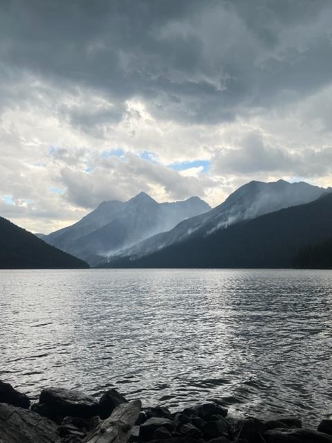
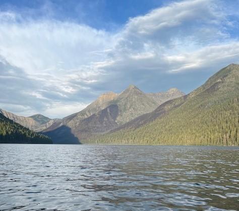
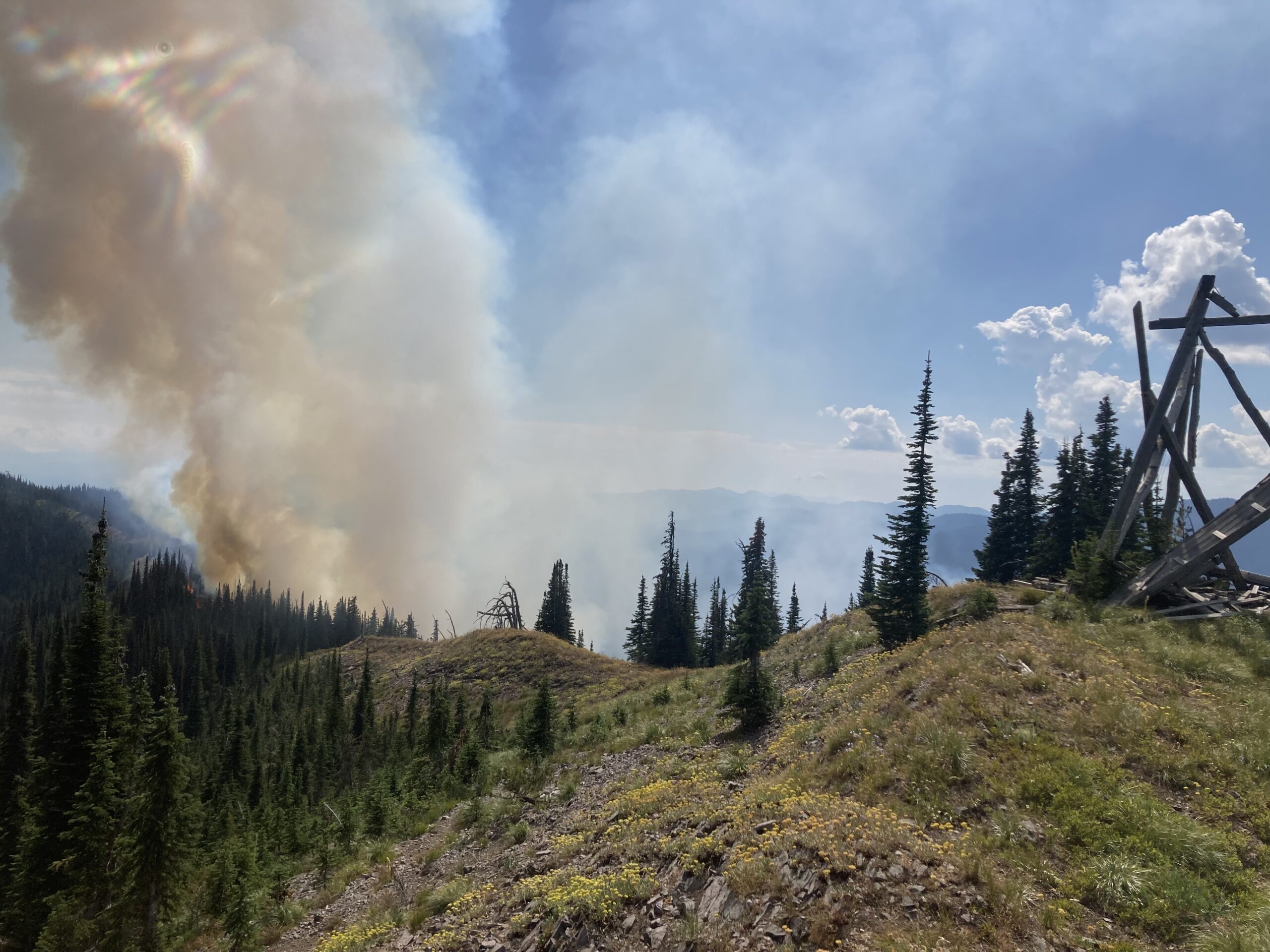
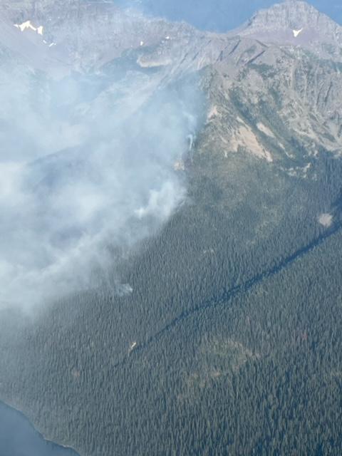
Quartz Fire before a rainstorm on August 23, 2022 – NPS
From the press release . . .
National Park Service Glacier National Park Incident Commander: M. Lewelling
Fire Information Email: glac_fire_line@nps.gov Fire Information Recording: 406-206-6099 Fire Information Office: 406-206-5272 (8 am to 6 pm)
Weather tempers fire activity on Quartz Fire
Current Situation: Weather has limited fire activity on the Quartz Fire over the past two days, and no measurable growth has been recorded. Additional rain is expected over the fire area today with a chance of lightning in the general area this afternoon.
Fire personnel continue scouting areas near the fire and assessing structures and other park facilities in anticipation of drier weather moving into the fire area and potential increased fire activity in the coming days. Crews continue to be available to respond to any new fire starts that may result from recent lightning.
Quartz Fire after rain showers on August 23, 2022 – NPS
Weather: Showers and thunderstorms are predicted to continue today. On Friday, showers and thunderstorm activity are forecast to become less widespread. A dry cold front is expected to pass over the fire area starting Saturday. The frontal passage is expected to bring lower relative humidity and gusty winds over the weekend and into early next week. These conditions may lead to increased fire activity through the weekend.
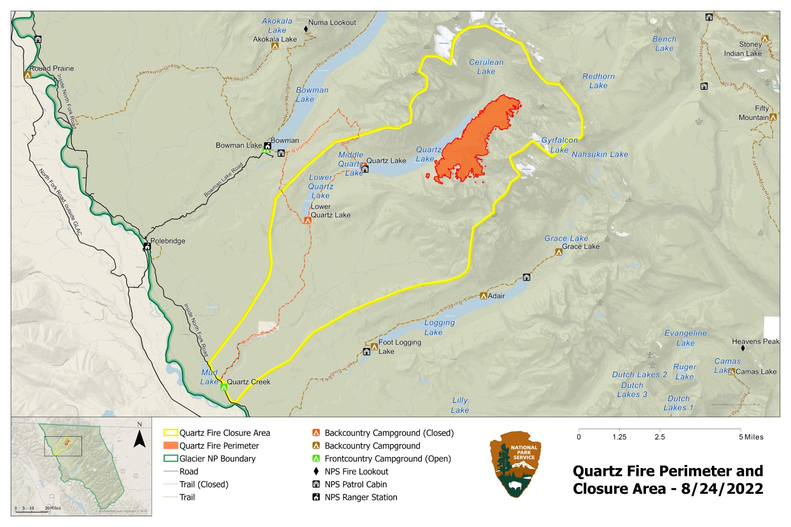
Closures: Glacier National Park has enacted a Closure Order for the areas, campgrounds, and trails within the Quartz Lake drainage from the Continental Divide to the Inside North Fork Road for the protection of park visitors, employees, and natural resources. This includes the Quartz Lake Loop trails starting from just south of Bowman Lake toward Quartz Lake, as well as the Quartz Lake and Lower Quartz Lake Wilderness Campgrounds. A map of the closure is available on InciWeb.
Fire Restrictions: The fire danger rating in Glacier National Park is currently Very High. All park visitors are reminded that campfires are allowed only in designated fire rings or grates and should be kept small. Never leave a fire unattended and drown any campfire with water until cold to the touch before leaving it.
Air Quality: National air quality and smoke conditions can be monitored at https://fire.airnow.gov/. Visibility in different parts of Glacier National Park can vary from hour to hour, depending on fire and wind conditions both locally and throughout the west. Check the park’s webcams at https://www.nps.gov/glac/learn/photosmultimedia/webcams.htm for current views.
Quartz Fire Statistics: Size: Approximately 1696 acres Total Personnel: 35 Start Date: Sunday, August 14, 2022 Containment: 0% Cause: Lightning Location: 25 miles north of West Glacier
Quartz Fire Perimeter and Closure Area, August 24, 2022
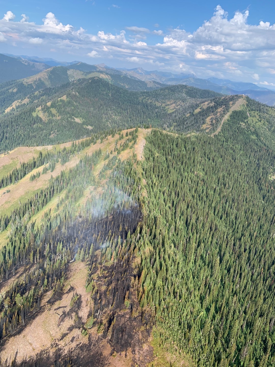
Coal Ridge Fire burn scar below old Coal Ridge Lookout site, August 24, 2022 – USFS
This information was received from Ryan Butler, Assistant Fire Management Officer-Operations for the Hungry Horse-Glacier View Ranger District. Note that the Coal Ridge Fire is still about 10 acres . . .
Yesterday was pretty uneventful on the Coal Ridge Fire. Cloud cover and high humidity kept fire behavior to smoldering of heavy fuels. Attached are some photos of our recon flight. As you can see in some of the photos north aspects are too wet to support fire. Ground crews will be out on the 317B rd again today and I will report back to you all if there is rain in the rain gauge. Once the T-storms and rain move out of the area, looks like Saturday, we will have a contingent back up on Coal ridge. As always, please feel free to reach out to me if you have question. Thank You.
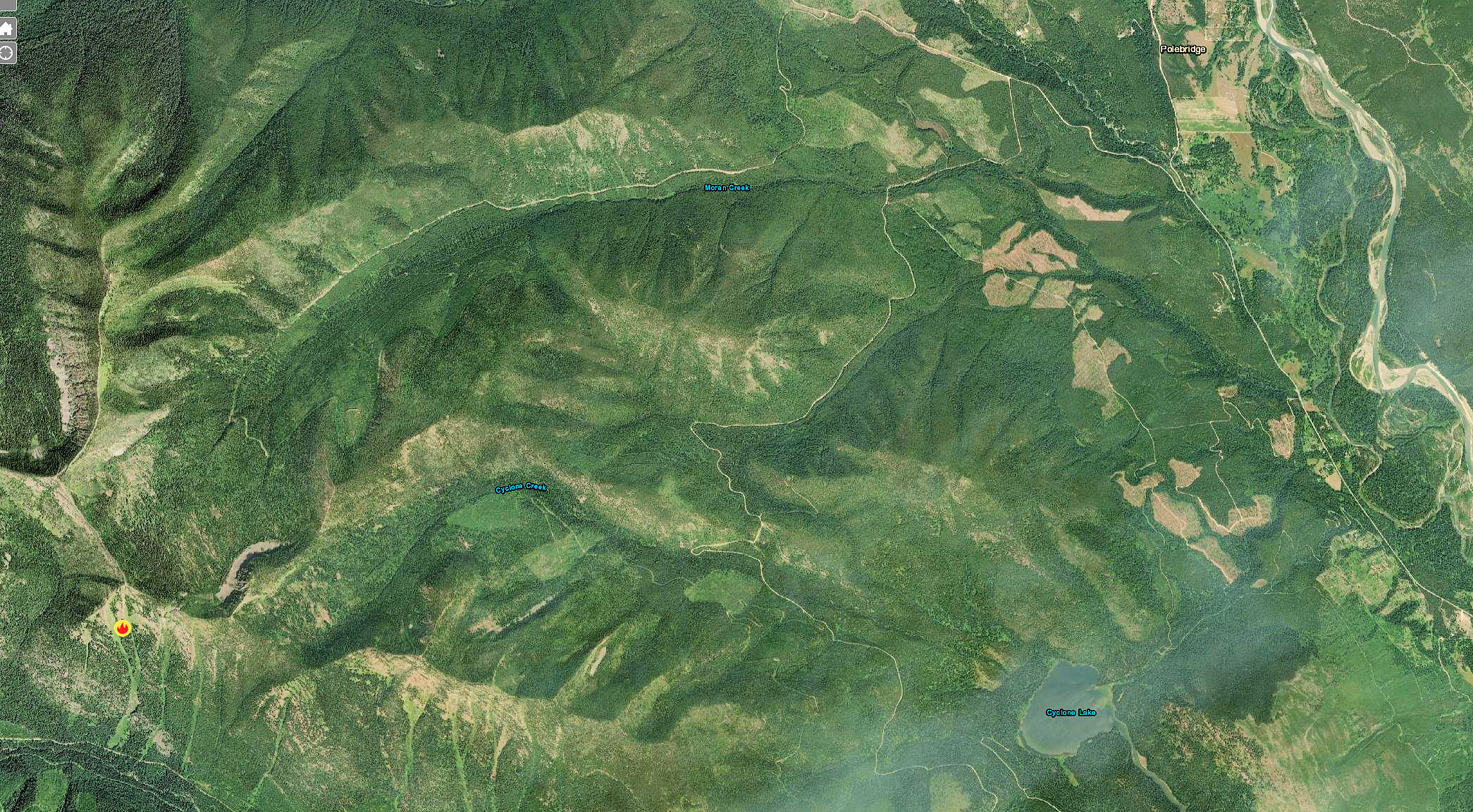
Coal Ridge Fire – view from south along ridgetop, August 24, 2022 – USFSCoal Ridge Fire Location
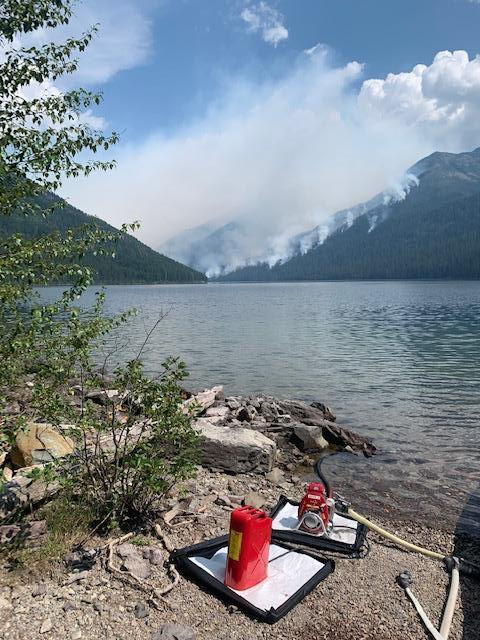
Structure Protection Pump and Quartz Fire August 21, 2022 – NPS
From the press release . . .
Incident Commander: M. Lewelling
Fire Information Recording: 406-206-6099
Fire Information Phone: 406-206-5272 (8 am to 6 pm)
Fire Information Email: glac_fire_line@nps.gov
Wet weather results in minimal growth on Quartz Fire
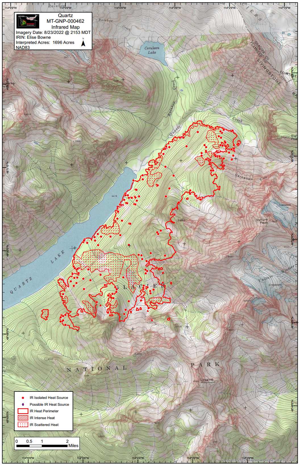
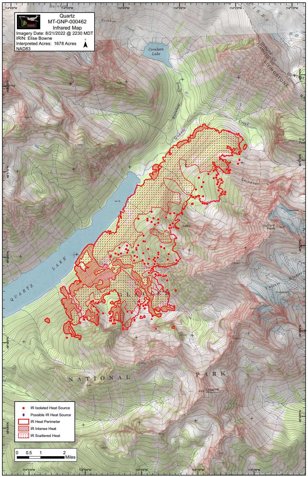
Current Situation: No new fire activity was observed on the Quartz Fire yesterday. Last night’s infrared flight mapped 18 acres of fire growth over the past two days, with the current fire acreage at 1696 acres. Scattered and isolated heat sources were detected with no areas of intense heat.
Wildland Fire Module crew members relieved Glacier National Park firefighters at Quartz Lake yesterday. Firefighters at Quartz Lake will continue structure protection efforts and scout areas near the fire. Additional crews will patrol both the east and west sides of Glacier National Park for any new fires resulting from recent and ongoing lightning.
Weather: Showers and thunderstorms are expected again today and are expected to become stronger in the afternoon. The National Weather Service has issued a Flood Watch from noon through late tonight. High temperatures are forecasted to be 80-90° in valleys and 63-73° on ridges. Rains in the fire area have increased humidity levels over the past few days. Higher humidity has contributed to reduced fire behavior. Humidity is expected to remain high into the weekend.
Closures: Glacier National Park has enacted a Closure Order for the areas, campgrounds, and trails within the Quartz Lake drainage from the Continental Divide to the Inside North Fork Road for the protection of park visitors, employees, and natural resources. This includes the Quartz Lake Loop trails starting from just south of Bowman Lake toward Quartz Lake, as well as the Quartz Lake and Lower Quartz Lake Wilderness Campgrounds. A map of the closure is available on InciWeb.
Fire Restrictions: The fire danger rating in Glacier National Park is currently Very High. All park visitors are reminded that campfires are allowed only in designated fire rings or grates and should be kept small. Never leave a fire unattended and drown any campfire with water until cold to the touch before leaving it.
Air Quality: National air quality and smoke conditions can be monitored at https://fire.airnow.gov/. Visibility in different parts of Glacier National Park can vary from hour to hour, depending on fire and wind conditions both locally and throughout the west. Check the park’s webcams at https://www.nps.gov/glac/learn/photosmultimedia/webcams.htm for current views.
Size: Approximately 1,696 acres Total Personnel: 35 Start Date: Sunday, August 14, 2022 InciWeb: https://inciweb.nwcg.gov/incident/8337/ Containment: 0% Cause: Lightning Location: 25 miles north of West Glacier Fire Information Office: 406-206-5272
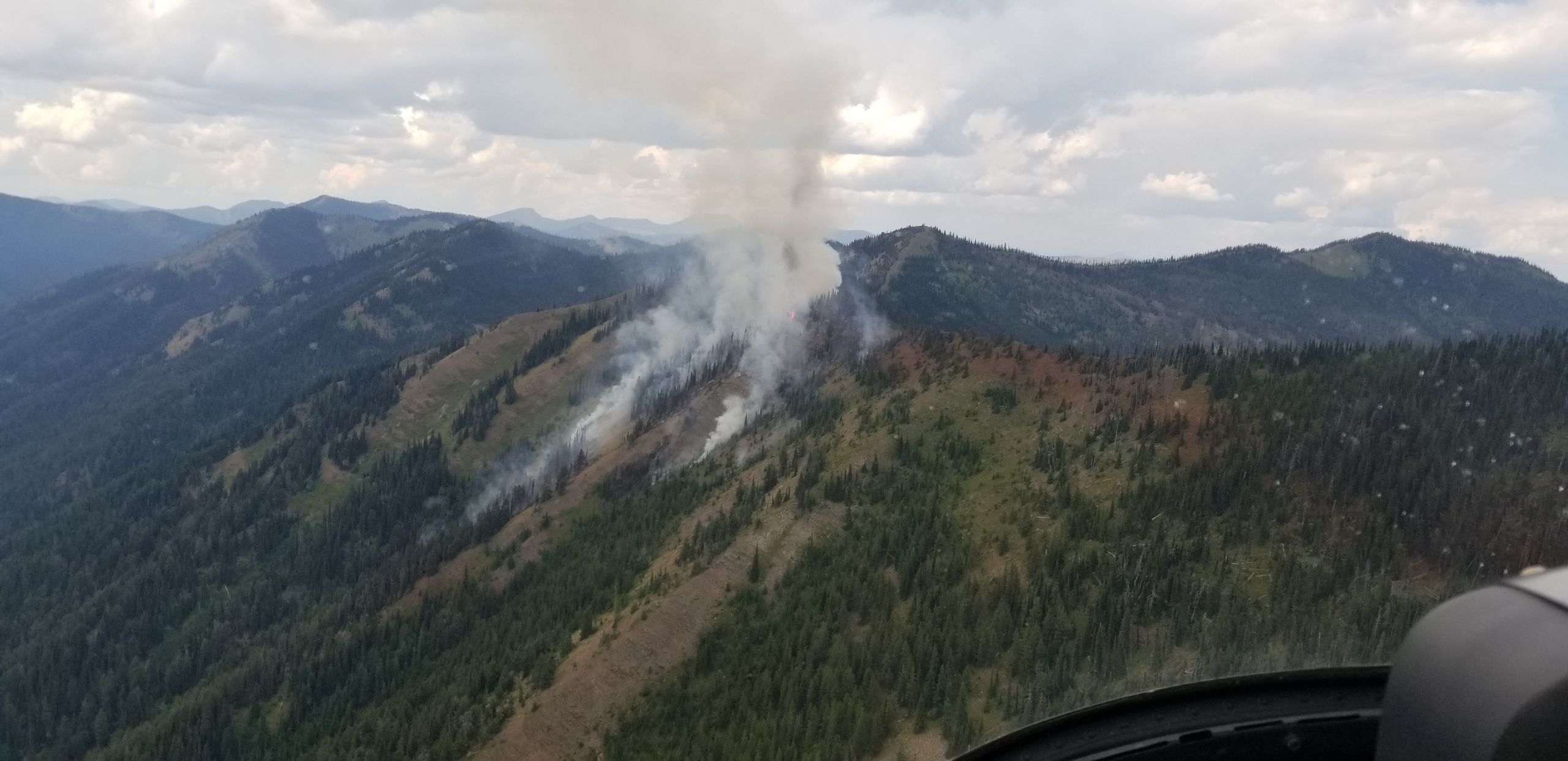
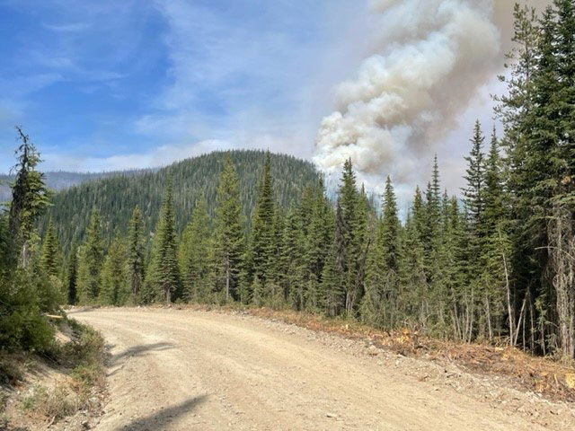
Coal Ridge Fire from the Ridge, August 23, 2022 – USFS
This information was just received from Ryan Butler, Assistant Fire Management Officer-Operations for the Hungry Horse-Glacier View Ranger District. Note that the Coal Ridge Fire is listed as a 10 acre blaze this morning . . .
An additional note from late this afternoon: “…no growth was shown on the fire overnight. Wetting rain was confirmed over the fire area and the fire is only smoldering in areas of heavy fuels. More wetting rain is anticipated over the next two days.”
Fire activity on Coal Ridge was brief yesterday. Not much growth observed from the day before. We did order Infrared Mapping last night (NIROPS) but they were unable to fly due to weather. We have an order placed tonight. This will give us a more accurate size and location of heat. Activity was mainly on the ridge top with single and group torching. As we have seen throughout the fire season on the district the north aspects don’t seem to be receptive to fire and we observed no fire on the north slopes in Moran Creek Drainage. We did have district fire folks on the ground yesterday to verify fire activity and difficulty in terrain. They had to take shelter in Moran Patrol cabin in the afternoon when a cell came over with heavy rain and hail. They guessed at least a tenth of rain on the fire. As always, please feel free to reach out to me if you have question. Thank You.
Coal Ridge Fire, August 23, 2022, 1325 – USFSCoal Ridge Fire Location
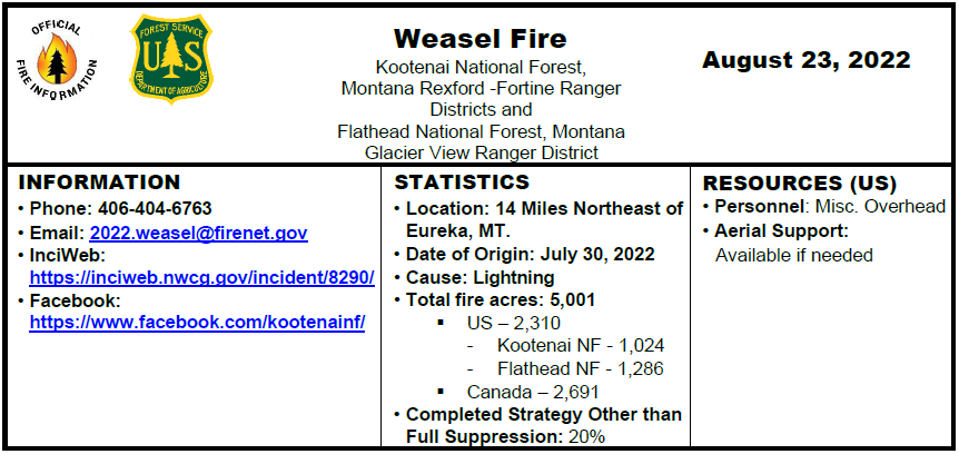
On Saturday, July 30, 2022, the lightning caused Weasel fire originated on the Kootenai National Forest and advanced across the Flathead National Forest into Canada. The National Forests are closely coordinating with the BC Wildfire Service Incident Management Team in Canada, located in Cranbrook. Reporting on the Canadian portion of the fire can be found at the BC Wildfire Service website.
The fire on the U.S. side is currently estimated at 2,310 acres. Yesterday fire activity continued to be slightly active with creeping, backing and individual tree torching due to winds and terrain. The fire continues to burn in heavy dense fuels in steep, rugged and unpopulated terrain.
Today, August 23, Firefighters continue to improve areas along roads, clear debris from the roadway and are providing point protection of resources in the area. Lower temperatures and an increased chance of rain showers is predicted with thunderstorms this evening. Fire managers continue to monitor, assess, and coordinate with Canadian efforts.
Fire information will be providing updates every other day unless significant changes occur.
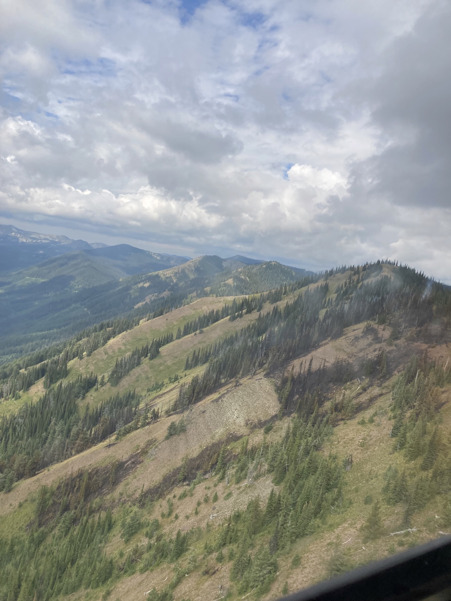
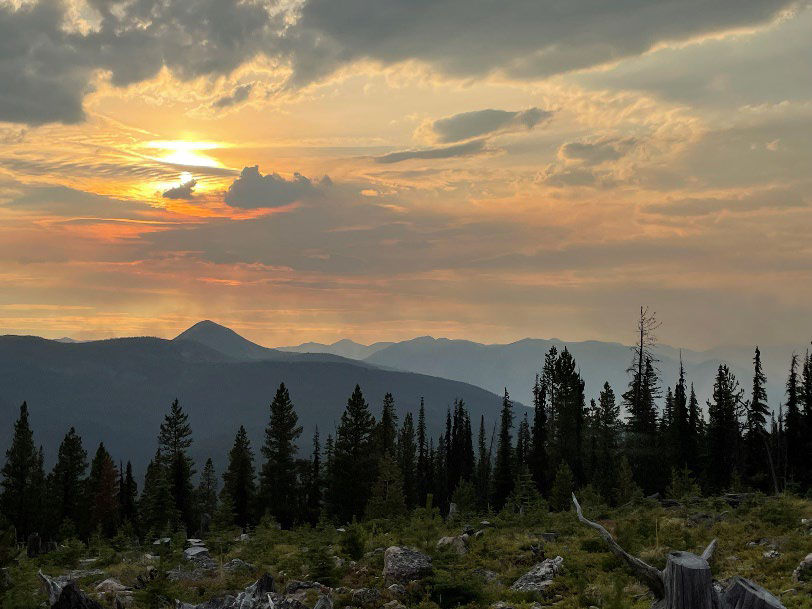
Weasel Fire from Thoma Lookout, August 22, 2022 at 1945 – Leif Haugen, USFS
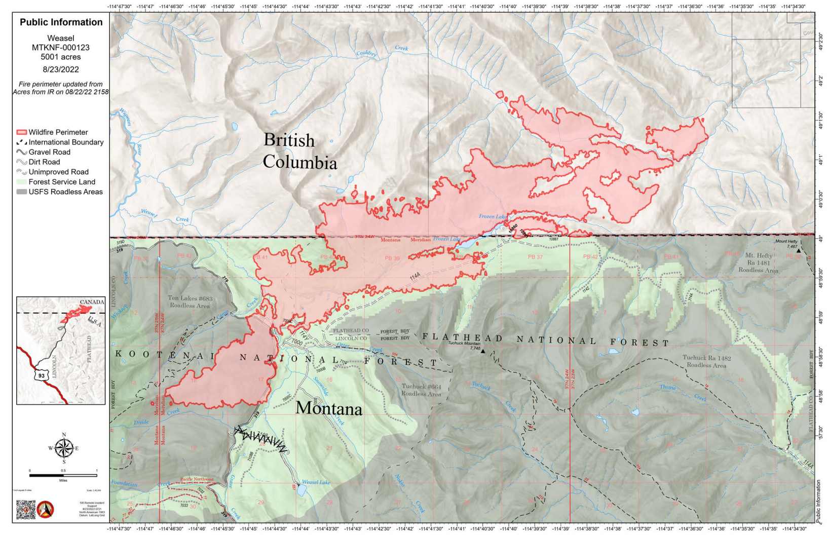
Map:
Weasel Fire Map, August 23, 2022
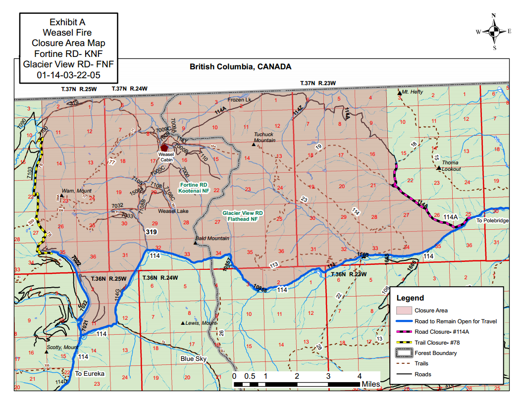
Current Closures:
An area closure order is in place and posted that restricts access to the burned fire area. The purpose of the closure is for public safety. The FS #319 road to the Weasel Cabin is closed, and FS #114 road to Polebridge is closed due to road construction unrelated to the fire. The fire closure and road construction closure maps are also posted on InciWeb.
Weasel Fire Area Closure Map
PREVENTION MESSAGE
Know Before You Go – Visit www.mtfireinfo.org for current Montana fire restrictions. Currently the Kootenai and Flathead National Forests are not in restrictions.
Fire Danger: Very High
When the fire danger is “very high”, fires will start easily from most causes. The fires will spread rapidly and have a quick increase in intensity, right after ignition. Small fires can quickly become large fires and exhibit extreme fire intensity, such as long-distance spotting and fire whirls. These fires can be difficult to control and will often become much larger and longer-lasting fires
Incident Commander: M. Lewelling
Fire Information Recording: 406-206-6099
Fire Information Phone: 406-206-5272 (8 am to 6 pm)
Fire Information Email: glac_fire_line@nps.gov
Additional firefighters arrive to Quartz Fire; West Flattop Fire contained
Current Situation: Fire activity moderated on the Quartz Fire yesterday due to slightly cooler temperatures and scattered rain. No significant growth was observed. Updated infrared mapping was not available last night, so the fire remains 1,678 acres.
Nine firefighters, known as a Wildland Fire Module, arrived to assist with management of the Quartz Fire. They will relieve Glacier National Park firefighters who had been assigned to the fire, freeing them to respond to any new fires detected from recent lighting. An additional engine with six firefighters has also arrived to assist with future initial attack needs.
Firefighters were successful in suppressing the West Flattop Fire at less than an acre. Three Glacier National Park firefighters were flown into the fire on Monday and contained the fire by late afternoon.
Weather: A low pressure system coming from the west will result in increased rain showers and thunderstorms over most of western Montana including Glacier National Park. There is a 60 percent chance of precipitation today, and those storms will bring a 50 percent chance of lighting. Today’s high temperatures are predicted to be 85-95° in valleys and 68-78° on ridges, with ridge top northeast winds of 5-10 mph becoming east later in the day.
Closures: Glacier National Park has enacted a Closure Order for the areas, campgrounds, and trails within the Quartz Lake drainage from the Continental Divide to the Inside North Fork Road for the protection of park visitors, employees, and natural resources. This includes the Quartz Lake Loop trails starting from just south of Bowman Lake toward Quartz Lake, as well as the Quartz Lake and Lower Quartz Lake Wilderness Campgrounds. A map of the closure is available on InciWeb.
Fire Restrictions: The fire danger rating in Glacier National Park is currently Very High. All park visitors are reminded that campfires are allowed only in designated fire grates and should be kept small. Never leave a fire unattended and drown any campfire with water until cold to the touch before leaving it.
Air Quality: National air quality and smoke conditions can be monitored at https://fire.airnow.gov/. Visibility in different parts of Glacier National Park can vary from hour to hour, depending on fire and wind conditions both locally and throughout the west. Check the park’s webcams at https://www.nps.gov/glac/learn/photosmultimedia/webcams.htm for current views.
Size: Approximately 1,678 acres Total Personnel: 30 Start Date: Sunday, August 14, 2022 InciWeb: https://inciweb.nwcg.gov/incident/8337/ Containment: 0% Cause: Lightning Location: 25 miles north of West Glacier Fire Information Office: 406-206-5272
Quartz Fire Heat Map, August 22, 2022Quartz Fire Closure Map, August 18, 2022
This information was just received from Ryan Butler, Assistant Fire Management Officer-Operations for the Hungry Horse-Glacier View Ranger District. Note that the Coal Ridge Fire is listed as a 10 acre blaze this morning . . .
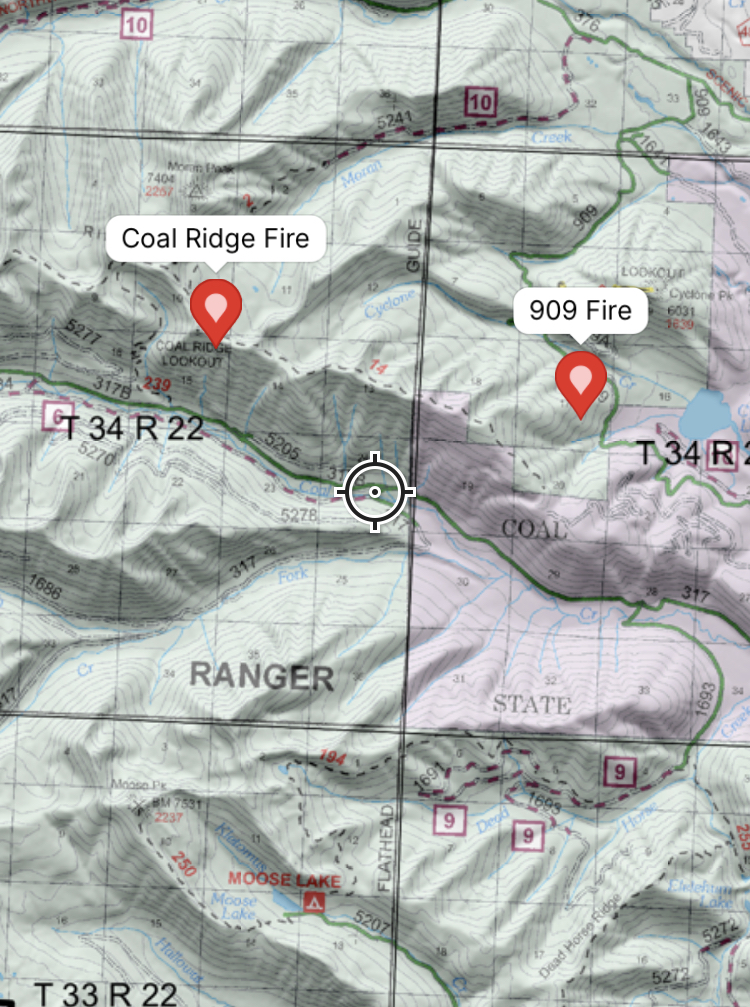
Yesterday the Coal Ridge fire was detected by Cyclone lookout. The local Flathead Helitack flew to the fire and gave a size up of: 1acre, torching, spotting, and making short uphill runs. The fire is on the upper third of the slope on a south aspect(see attached photo). Air attack was over the fire and used heavy air tankers and heavy helicopters to attempt to keep the fire from progressing over the ridge and down slope. Due to the steep rocky terrain we determined ground crews would not be successful suppressing this fire using direct tactics. Today we will have personnel hiking in trail 2 from the Moran creek side to assess fire conditions on the ground. We will also be posting signs at the trailhead of trails: 239,2 and 4. We are currently assessing area and trail closures. We will send out more information in the days to come…
The 909 fire was also detected yesterday. Its location is west of Cyclone lake between the 909 road and a decommissioned logging road. This fire is staffed and contained. No issues or concerns.
Coal Ridge Fire LocationCoal Ridge and 909 fire locations – USFS
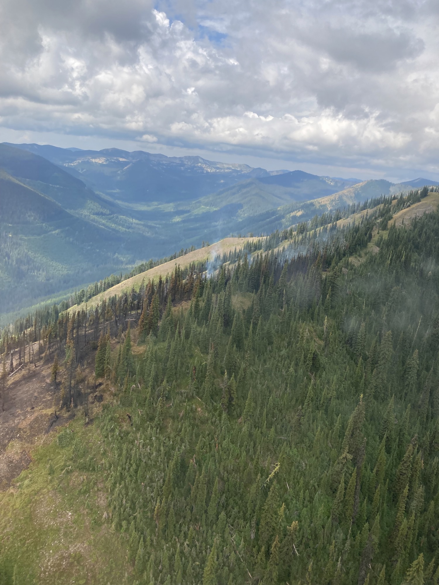
Weasel Fire from Weasel Lake Road, August 22, 2022 – RJ McDole, USFS
(NOTE: Unless something exciting happens with the Weasel Fire, this will be the last morning update for this blaze. Instead, I’ll be passing along the official “Fact Sheet” which is usually released in the afternoon. – ww)
Summary: The Weasel fire remains active, gaining 408 acres since the last reliable estimate about three days ago. In the U.S., the fire is 20% contained; Canada is also establishing containment lines to the east.
According to this morning’s IR (heat mapping) pass, the Weasel Fire gained 408 acres since the last accurate estimate about three days ago and was estimated at 5001 acres. The fire is still active and expansion was broadly distributed. Better than half (55%) of the fire is in Canada. The fire is now 20% contained within the U.S. section; Canadian personnel have been establishing containment lines along the fire’s northeastern/eastern flank to block spread into the Flathead Valley. The blaze is currently burning in the Kootenai National Forest (19%), the far northwest corner of the North Fork in the Flathead Forest’s Glacier View district (26%), and in Canada (55%). See the attached map for fire location and extent.
The US and Canada are working together to control the Weasel Fire. From the InciWeb site: Jurisdictional collaboration is occurring between the Incident Management Team (IMT) in the United States located in Eureka, Montana and the BC Wildfire Service Incident Management Team in Canada, located in Cranbrook. The two IMT’s are closely coordinating on wildfire management and are sharing resources as required.
The area closure associated with the fire was finalized August 9 and includes segments of both the Kootenai and Flathead Forests. For the North Fork, this affects an area above Trail Creek Road north to the border and from the Whitefish Divide east to the Frozen Lake Road vicinity. Trail Creek Road remains open. See the attached map and closure order document. Also note that, beginning August 22, major work will be in progress in the Glacier View Ranger District on Trail Creek Road (NFS 114) that will restrict travel for about a month.